V spun the Other 54 Randomizer, and up came "Saddleback Mountain (Jay Range)". Our fate is sealed. Jay is nearby so we will hike both mountains. Thankfully there are trails up both mountains, with just a short bushwhack in between. Jay and Saddleback are in the upper right area of the interactive map below:
Here is a map of the trails in the area (click here for an interactive version):
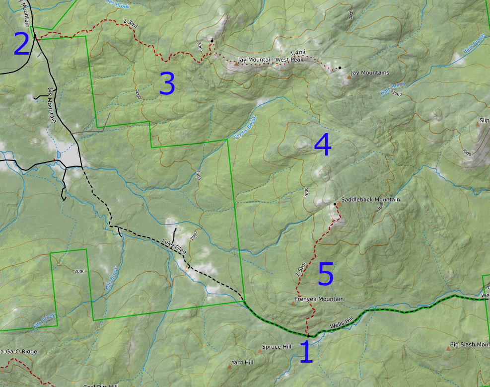
The plan is to drop off a bike at the bottom of the Saddleback trail (1), then park at the Jay Mountain Trailhead (2), hike the Jay peaks (3), bushwhack to Saddleback (4), hike down (5) to where we dropped off the bikes (1), and bike back to the car (2).
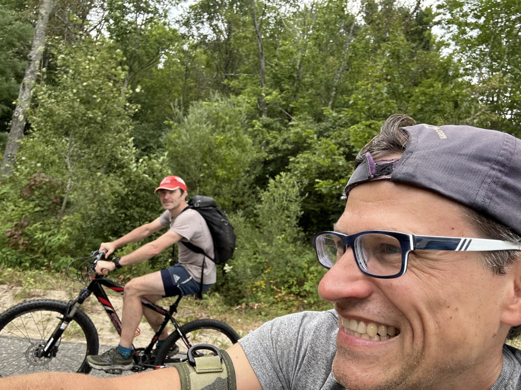
We met up and dropped bikes off at (1). The dirt road was too steep to drive, so we ended up locking the bikes in the woods a little bit west of where we planned. After the drive to the trailhead (2), the hike up the various Jay peaks was pleasant and rewarding, with many open faces and ridges and great views along the way. The sky was thick with clouds and smoke from the fires in Canada but seeing mountains in the distance with taller mountains behind them and even taller mountains behind those just barely in view through the haze may have made them even more impressive.
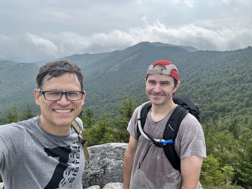
This area is a fantastic angle from which to check out the high peaks region from afar. The plant life is unique here. It certainly feels like the Adirondacks, but with some lowland flora mixed in. We came across a scant few blueberries, some red raspberries, and a bunch of chokecherries. I sampled a few handfuls of chokecherries. They have a strong, bitter, mouth-drying aspect, but after the shot of bitterness of the first mouthful, the feeling levels off on subsequent mouthfuls. They have a very unique texture, and were more filling than most small foraged fruits, despite having to spit out a pit from each small cherry. The geology is also very unique. Red minerals, perhaps iron, are visible in the rock faces. "Puddles" of red dust where the red dust appears like it has eaten its way into the rock by a half inch or so are common.
I felt a weird fatigue on the drive, and I was feeling it on the steady climb up as well. Steady walking was ok, even uphill, but any kind of effort requiring oomph just wasn't there today. It's definitely some of the malaise I've been feeling since having Covid 2+ years ago. The last several weeks have been a steady flow of mild activity without any significant days of recovery. The way it seems to work is that I have a very limited supply of energy for dealing with activity, stress, heat, etc. If I can manage my activity and stress such that I keep it under a certain level and include plenty of recovery, I can feel pretty ok. But I suspect I have been neglecting recovery during a steady stream of activities and it's catching up with me. Summer is tough! There is a lot going on!
We reached the final Jay peak, and checked out the 2 survey benchmarks before proceeding to bushwhack our way to Saddleback. We had it in our heads that it was "like a mile" and would be quite easy compared to our other recent bushwhacks which were much longer. I don't know why, but this was a tough and long bushwhack. Maybe my fatigue was part of the reason, and V tweaked an ankle early on so I'm sure that didn't help either. But it was not too hot, there were absolutely no bugs, and the woods weren't super thick so our legs weren't getting particularly scratched. Sure there were a few obstacles to deal with, and it was definitely a bit challenging. But it just seemed to go pretty slowly. I saw some pretty interesting scat. Some looked like a big pile of deer scat except different in that it was more of a pile and seemed soft, so I'm not sure what that was. Then we saw some other scat that looked almost like human scat in shape, but one of the older piles clearly consisted entirely of something like mouse fur and bones.
I felt eager to get to Saddleback, where I had envisioned an open peak with an easy and clear trail to the bottom. But that was not what we found. There is a trail that is easy to follow, but it doesn't go to the actual peak. So we bushwhacked around in circles at the top of the peak unsure of whether we officially visited the top or not. Eventually we figured out that a short cairn with several rocks stacked on top of each other marked the official peak. Only then did we make our way down the mountain and eventually find the actual herdpath. After that it was smooth hiking to the bottom. Once at the road, it was a short walk to the bikes. Then we had an uproariously fun descent since the road is almost entirely steep downhill.