|
Site.SideBar
|
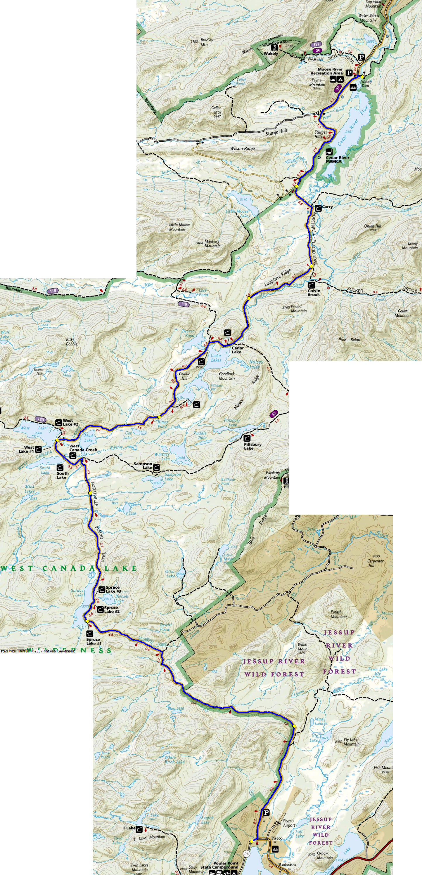
- Start @ Wakely Dam, finish @ Orondequoit Inn, Piseco Lake
- Total elevation change 7000, 400' net downhill. Steadyish elevation from mile 11-22. Last 6 miles lots of downhill. According to NatGeo mapping program, 31 miles.
- Map
- Trail conditions(?)
What to bring
- Camelback
- Map
- Compass
- Plenty of food for 8 hours of running
- Water
- Water pills
- Polypro top(?)
- Athletic tape/Moleskin/Band-aids
Decisions to make
- Footwear: sandals, minimus?
- Food to bring
- Stuff to take
- Sleeping & travel arrangements
Things to start doing
- Eat a hearty breakfast before runs
- Run lots of hilly trails
- Trail marker at West Lake intersection:
|


